
Maps and access
Two ways in.
Download before you go.
Glamis is reached from Highway 78 east of Brawley, California, or from Interstate 8 west of Yuma, Arizona. Which one you use is usually decided by where you are towing from, and increasingly by which side of the state line you want to buy fuel on.
Getting there
The two approaches
| Approach | Route | Worth knowing |
|---|---|---|
| From the west | Highway 78, east of Brawley | The California side. Brawley and El Centro are the supply towns. |
| From the east | Interstate 8, west of Yuma | The Arizona side. Yuma fuel is usually materially cheaper. |
Both are published by BLM as the primary access. Compare live fuel prices on each side →
Before you lose signal
Download it
while you still can.
Assume no coverage
Do not plan on having a working connection out on the sand. Whatever map you intend to rely on, have it stored on the device before you leave the highway.
Carry the official map
BLM publishes the recreation area map showing boundaries and access. That is the one that governs where you may legally ride, whatever any other app shows.
Know your access road
Remember which road you came in on. It is the first question anyone coming to help will ask, and on open sand it is easy to lose track of which direction the highway is.
A map is not a plan
Forty miles of dunes with few reference points defeats casual navigation. Tell people at camp roughly where you are going and when you expect to be back.
The boundary that matters
North Algodones
is closed to vehicles.
The North Algodones Dunes Wilderness is closed to all vehicles and mechanized use. It is permanent and it covers a significant part of the dune system. Any route planning has to account for it, and no permit provides an exception.
Temporary closures also happen, and they change with little warning. Osborne Overlook was closed through the end of July 2026 for parking improvements, which is the kind of notice that appears and disappears between trips. The current holiday notice also restricts overnight camping there on select 2026-27 holiday windows, while day use remains open; see the exact dates on the camping page.
Cement Flats is different: the area is closed to camping and recreational use from September 8, 2026 through February 2028 while it serves as the temporary ranger station. The camping page has the closure details; do not plan a camp there.
Check blm.gov or call the El Centro Field Office on (760) 337-4400 before you travel rather than trusting any date printed here.
The map
Satellite view,
official coordinates.
Every point on this map uses coordinates published by BLM for that site, not a pin dropped by eye on a satellite image. Tap a marker for what is there and the coordinates it came from, or pick one from the list to fly straight to it.
Imagery from Esri. Boundaries are BLM's own Open and Limited OHV geometry, not traced from the imagery. Scroll-wheel zoom switches on once you click the map, so the page still scrolls normally on a phone.
All 40 locations, as a list
Every named place, and the ones BLM will not name
If you have ever asked a group for the map with the wash numbers on it and got forty different answers, this is why. BLM publishes a coordinate table in its Imperial Sand Dunes brochure, and that table names four numbered washes: 4, 6, 10 and 20. It does not name washes 1, 2, 3, 5, 7 and the rest, and it does not name Vendor Row. Those are rider vernacular. They are real places, they are just not places any agency has put a coordinate on.
Everything below is from that BLM table. Nothing here is placed by eye off satellite imagery and nothing is a rider estimate. Coordinates are WGS 84 in decimal degrees.
North Dunes
| Place | Coordinates | Type | Surface | Worth knowing |
|---|---|---|---|---|
| Mammoth Wash | 33.129700, -115.274783 | Camping area | Nonmaintained gravel | The far north end of the recreation area. |
| Cement Flats | 32.974700, -115.176483 | Temporarily closed | Gravel | Closed to camping and recreational use through February 2028 while it serves as the temporary ranger station. |
| Palo Verde Flats | 32.994150, -115.090367 | Camping area | Nonmaintained gravel | |
| Gecko Loop | 32.939717, -115.142767 | Camping area | Paved road | Toilets. Largest campground in the recreation area, north and south loops. |
| Glamis Flats | 32.992217, -115.079150 | Camping area | Gravel | Toilets |
| Keyhole | 32.915667, -115.116433 | Camping area | Paved road | Smallest campground, a single paved keyhole. |
| Osborne Overlook | 32.983033, -115.132900 | Camping area | Nonmaintained gravel | Toilets. Roadside overlook with views over the dunes and the Imperial Valley. No permit needed for short day use. |
| Pad 1 | 32.968000, -115.171333 | Camping area | Gravel | |
| Pad 1.5 | 32.960550, -115.168050 | Camping area | Gravel | |
| Pad 2 | 32.955700, -115.162150 | Camping area | Gravel | |
| Pad 2.5 | 32.944950, -115.146533 | Camping area | Gravel | |
| Pad 3 | 32.934517, -115.136183 | Camping area | Gravel | |
| Pad 4 | 32.923900, -115.121533 | Camping area | Gravel | |
| Pad 5 | 32.932500, -115.135550 | Camping area | Gravel | |
| Roadrunner | 32.912500, -115.117767 | Camping area | Paved sites | Toilets. Second largest campground, at the end of Gecko Road. |
| Wash 4 | 32.990800, -115.061517 | Camping area | Nonmaintained gravel | Toilets |
| Wash 6 | 32.988100, -115.057000 | Camping area | Nonmaintained gravel | Toilets |
| Wash 10 | 32.980383, -115.046017 | Camping area | Nonmaintained gravel | Toilets |
| Wash 20 | 32.954850, -115.014017 | Camping area | Nonmaintained gravel | |
| Cahuilla Ranger Station | 32.973333, -115.173050 | Access point | The main ranger station, on Gecko Road. | |
| Competition Hill (Hill 1) | 32.984200, -115.127517 | Landmark | ||
| Oldsmobile Hill (Hill 2) | 32.962783, -115.098883 | Landmark | ||
| Brawley Slide (Hill 3) | 32.944200, -115.079917 | Landmark | ||
| Lizard Hill (Hill 4) | 32.927933, -115.068067 | Landmark | ||
| China Wall (Hill 5) | 32.911750, -115.040867 | Landmark | ||
| The Wall (Hill 6) | 32.889833, -115.041350 | Landmark | ||
| The Ceiling (Hill 7) | 32.875100, -115.016433 | Landmark |
South Dunes
| Place | Coordinates | Type | Surface | Worth knowing |
|---|---|---|---|---|
| Buttercup | 32.738933, -114.878467 | Camping area | Paved road | Toilets, Dumpsters |
| Dune Buggy Flats | 32.713617, -114.942500 | Camping area | Nonmaintained gravel | Toilets, Dumpsters. Also called Gordons Well. |
| Dunes Vista | 32.763883, -114.837217 | Camping area | Nonmaintained gravel | |
| Grays Well | 32.710433, -114.924833 | Camping area | Paved access road | Toilets |
| Midway | 32.721400, -114.913267 | Camping area | Paved road | Toilets |
| Ogilby | 32.810833, -114.888883 | Camping area | Nonmaintained gravel | |
| Buttercup Ranger Station | 32.738550, -114.885033 | Access point | Permits, information and medical aid. Open Friday to Sunday, mid October to mid April. | |
| Herman Schneider Memorial OHV Bridge | 32.705367, -114.957217 | Access point | OHV crossing at the south end. | |
| South Competition Hill | 32.731117, -114.883050 | Landmark | ||
| Test Hill | 32.738083, -114.897550 | Landmark | ||
| Buttercup Valley | 32.730000, -114.883417 | Landmark | Where the Return of the Jedi sail barge set was built in 1982. Nothing of it remains. | |
| Patton Valley | 32.780550, -114.948050 | Landmark | Named for the Desert Training Center that covered this desert from 1942. | |
| Plank Road | 32.710283, -114.939167 | Landmark | Surviving segment of the 1915 wooden road across the dunes. Managed as an Area of Critical Environmental Concern. No permit needed for short day use. |
Every row here has its own link. Send someone straight to a place with the place name on the end of the address, for example glamisduneguide.com/maps.html#wash-6.
Being straight with you
What the map
does not show yet.
Everything pinned here comes from BLM's published coordinate table: 25 camps and staging areas, the seven numbered hills, both ranger stations, the Plank Road and the rest. The Open and Limited boundaries are BLM's own GIS geometry rather than lines drawn over a satellite image. Each pin shows its source and the date it was checked.
What is still missing is the rider vocabulary that BLM does not publish coordinates for. Vendor Row is the obvious one, along with the wash names that do not appear in the official table. Those go on when someone who rides here can place them, with a name against the verification, and not before. A named place pinned in the wrong spot is worse than no pin at all.
Take the official map with you as well. It is built for offline GPS use, which matters in a place where coverage is unreliable.
Dune Guide Adventures
Put the Glamis map under your tires.
Choose a Glamis camp or staging start, explore the immense virtual dune field, and practice using Camp Compass before the real trip.
Glamis Adventure available now.
Explore Glamis in the free Arcade →The virtual world is for familiarization and fun. The current BLM map, closures, and posted signs control real access.
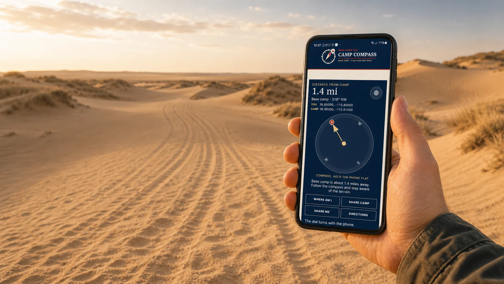

Free safety tool Works beyond the bars
Mark camp.
Find your way back.
Save camp before you ride. Camp Compass uses GPS satellites to show the distance and direction back, even where cell service disappears. Your marked camp stays on this phone unless you choose to share it.
- Works offlineGPS does not need a cell tower
- One compassUse it at every Dune Guide destination
- Share your locationSend coordinates when help can reach you
Set it up before the trip. Installation needs a signal.