
Riding
Forty miles
of open sand.
Scale is what separates Glamis from almost everywhere else. The dune system runs roughly forty miles, with no vegetation on the faces and nothing to break up the ground. That is the appeal, and it is also the thing that catches people out.
The terrain
Nothing to
judge distance against.
Open sand gives you very few reference points. A ridge that looks like a short run is a long one, a bowl that looks shallow is not, and a camp that felt close on the way out is a serious distance back when something breaks. People routinely misjudge how far they have gone, which is a navigation problem and a fuel problem before it is a riding problem.
Sand also changes through the day. Morning sand and afternoon sand do not behave the same way, and the same line can feel like two different pieces of terrain either side of lunch.
The sightline problem
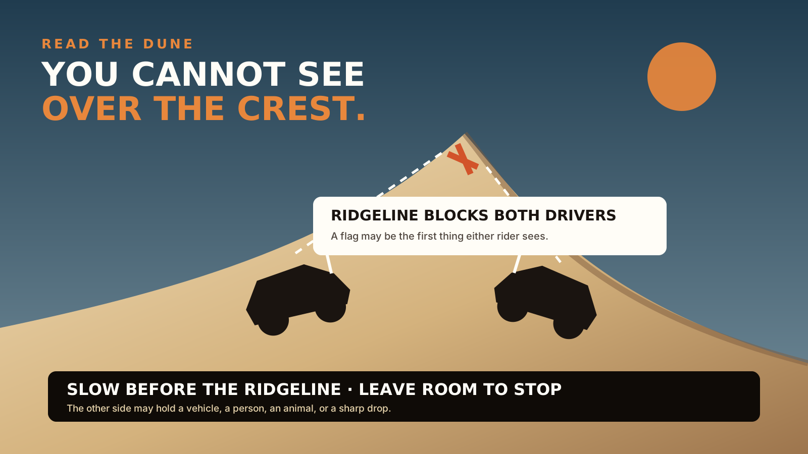
You cannot see
over a crest.
Blind by design
Climbing one face of a dune, you have no view of what is climbing the other. Two machines can crest at the same moment with no warning at all, which is the mechanism behind the worst incidents in any dune system.
The flag above the ridge
The whip flag is visible over the crest before the machine is. That is the entire point of the rule and the reason the dimensions are specified so exactly: 6 by 12 inches, 8 feet from the ground, within 10 inches of the tip.
Crest with room
Approach ridges expecting something on the far side, and leave yourself the option to change line. A flag tells you a machine is there; it does not tell you how fast it is arriving.
96 dBA, and useful
The sound limit is a regulation, but a machine you can hear is a machine you have some warning about. Capped at 96 dBA for anything built since 1986, 101 dBA for older. Full rules →
Where you cannot ride
The wilderness
is closed.
The North Algodones Dunes Wilderness is closed to all vehicles and mechanized use. It is permanent, it is a substantial piece of the dune system, and no permit changes it. If you are planning a long run, know where that boundary sits before you set off rather than finding it.
Individual areas also close temporarily, the way Osborne Overlook did through July 2026 for parking work. Those notices come and go, so check current ones before travelling rather than relying on a date printed here. The maps page covers access and orientation.
Being straight with you
The local detail
is still coming.
Everything above is either published by BLM or general to riding open dunes anywhere. What is deliberately missing is the part only regulars can tell you: which areas suit a first-timer and which will genuinely hurt someone who is not ready, the natural progression from one piece of terrain to the next, and which landmarks people actually navigate by.
That is being gathered from riders who know the place rather than assembled from forum posts, and this page will carry it when it arrives. Until then, treat unfamiliar terrain here as bigger than it looks and ride it with someone who has been before.